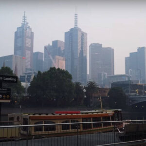
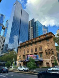
Melburnians awoke to a layer of smoke enveloping the city on the final day of the holiday weekend.
VicEmergency issued a warning for people in eastern Melbourne and Mount Dandenong on Sunday night, informing them of a planned burn in the Yarra Ranges.
Smoke might be visible to adjacent houses and roadways, according to the report.
“In case you were wondering where all the smoke has suddenly come from (because it was perfectly clear outside at 1830) it’s from the Planned Burns in Montrose / Mt Evelyn Area,” the Lilydale SES said on Facebook.
“Please take care of yourself, consider closing windows and having your reliever medications handy if you need them.
“Planned burns are important to keep fuel loads low, and it would seem the lower temperatures and change of wind direction has started moving the smoke Lilydale and Mooroolbark bound.”
A shroud of smoke has dropped on the city on Monday morning.
Weather Forcast in Victoria
Due to a humid and unstable air mass above eastern Victoria, the city’s smoky haze developed following widespread thunderstorms throughout the state on Sunday night.
More rain could reach in the state’s west as early as Monday evening, with the possibility of more light rain for Melbourne.
With a high of 28C anticipated on Tuesday, people returning to work after the long weekend will be feeling the heat.
Thunderstorms are also likely later in the day, along with heavy rain.
A sequence of upper-level troughs is moving westward into Victoria, and the cold front is likely to arrive on Wednesday.
Then, on Thursday, there’s a good chance of showers, with up to 10mm of rain possible and a high of 28°C.
The temperature is anticipated to dip to 21 degrees Celsius on Friday, and the weekend will be somewhat colder than the rest of the week, with highs of 22 degrees Celsius on both Saturday and Sunday.


